


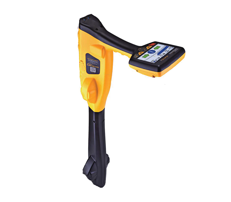


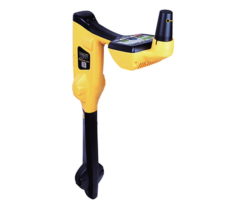
RTK-Pro Utility Locator with Survey-Grade GNSS
The vLoc3 RTK-Pro receiver is the first to add RTK GNSS accuracy to a utility locator. Using the RTK-Pro internal cellular module with 4G LTE
capabilities, the operator has the ability to connect to NTRIP RTK (Real-Time Kinematic ) caster that provides RTCM 3 corrections. By utilizing these
corrections, the operator can collect both utility location data along with the geographical location of the utility with survey-grade accuracy.
The RTK-Pro is designed for all operator levels, utilizing user-friendly and intuitive locate screens. Operators simply confirm the utility data
with the press of a button and align the electronic spirit level to store the data. All field data is sent to the cloud and retained in the
receivers on board storage for review and exporting to external mapping programs.
The user-configurable vLoc3 series receivers contains eight passive locate modes, fault find mode, SD (showing the direction of outgoing
current), and a range of configurable frequencies from 16Hz to 200 kHz. Visual and mechanical vibration alerts can also be configured by
the user providing warnings for shallow depth, overload, overhead cables, and excessive swinging. Optional features include Tx-Link that
enables the user to change the frequencies of the transmitter, power output and operate most of the features of the transmitter remotely.
Specifications:
• Fully-integrated RTK GNSS
• One-hand locating and mapping
• Cloud-based data management
• Survey-grade GNSS Accuracy
• Simplistic locating modes
• Reduces excess field equipment


| Display | High-Visibility Color Display 4.3’’/10cm with 480 x 272 resolution |
| Battery life | Lithium-ion – 16 hours of continuous use |
| Operating frequencies | Configurable frequencies from 16Hz to 200kHz Power – 50Hz and 60Hz Radio – 10kHz – 22.7kHz bandwidth |
| Receiver Antennas and Locate Modes |
– Two sets of Omni Directional antennas – Classic Screen with bar graph indicator with Peak, Null, Simultaneous Peak with Arrows, and Omni Peak – Vector Screen for when access directly over the utility is not possible, the locator offset and depth are displayed – Plan View displays the theoretical line in 2D from above ground in omnidirectional mode – Transverse Graph is used to analyze the shape of the fields – Sonde Screen guides you directly to the sonde with minimal control adjustment |
| Data logging and transfer | – Real Time upload connection to VMMap server via cellular connection – Run analysis from VMMap web portal to determine best practices – Export data to .csv, shapefile, .KML |
| GNSS Features | – Satellite Tracked: – GPS/QZSS, GLONASS, Galileo, BeiDou – GPS L1C/A L2C, GLO L1OF L2OF, GAL E1B/C E5b, BDS B1I B2I, QZSS L1C/A L2C – Position accuracy RTK 0.01 m + 1 ppm CEP – Convergence time RTK < 10 sec - Acquisition: Cold starts = 24s, Reacquisition = 2s - Dependent on atmospheric conditions, baseline length, GNSS antenna, multipath conditions, satellite visibility , and geometry |
| NTRIP | – Compatible with Casters with R TCM3 output messages – Real time reference station connection status displayed on the receiver – Real time horizontal accuracy in 2DRMS |
| Cellular Connection | – 4G with 3G fallback – LTE FDD bands 2, 4, 5, 7, 17 – UMTS/HSPA [MHz]850, 900, 1700, 1900, 2100 |
| Weight | – 5.5 lbs. / 2.4kg. |
| Environmental | – IP65 and NEMA 4 |
| Dimensions | 15″ x 30″ |
| What’s in the Box: | – Custom Li-ion battery with charger – Alkaline battery pack – Mini USB lead – User manual – Soft shell hard carry case |